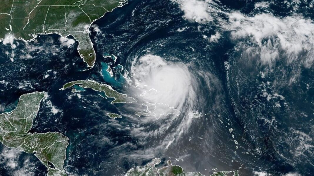
The Atlantic’s first hurricane of 2025 wasted no time making history. Hurricane Erin will be remembered as one of the fastest-strengthening Atlantic hurricanes on record, with perhaps the fastest intensification rate for any storm earlier than September 1, CNN reports.
At 11 a.m. ET on Friday, August 15, Erin was a Category 1 hurricane, according to the National Hurricane Center. Over the next 24 hours, this storm strengthened significantly. By 11 a.m. ET on Saturday, the NHC declared Erin a “catastrophic” Category 5 hurricane. Since then, Erin has weakened into a Category 4 storm, but the extremely rapid intensification it underwent over the weekend points to a troubling phenomenon largely driven by rising global temperatures.
If much of this sounds familiar, you may be remembering Hurricanes Helene and Milton. Hitting in the fall of 2024, both of these storms rapidly intensified before slamming into the U.S. East Coast. Rapid intensification occurs when a tropical cyclone’s maximum sustained wind speed increases by at least 35 miles per hour (56 kilometers per hour) within a 24-hour period, according to the NHC.
Like Helene and Milton, Erin rapidly intensified over higher-than-average sea surface temperatures. Forecasters predicted this would happen as the storm moved into the Caribbean, but Erin exceeded their expectations, strengthening into a Category 5 storm practically overnight. This may be due in large part to the fact that the Atlantic Basin is experiencing a marine heatwave. Heat adds energy to tropical cyclones, priming them for rapid intensification.
Category 5 hurricanes are relatively rare in the Atlantic Basin. Erin is one of just 43 on record, according to CNN. That said, roughly one quarter of these storms have occurred since 2016—a statistic that underscores the effects of climate change on hurricane season.
Multiple studies show that rapid intensification is becoming more frequent and severe as sea surface temperatures rise. At the same time, human-driven global warming exacerbates another important storm-strengthening factor: atmospheric moisture. As such, the conditions that cause a cyclone to explode in strength within a short window have become mainstays of hurricane season.
Since 1979, human-driven warming has increased the global likelihood of a tropical cyclone developing into a major hurricane by about 5% per decade, according to one recent study. Between 1980 and 2023, 22% of landfalling Atlantic tropical cyclones experienced extreme rapid intensification like Erin did, according to Climate Central.
As we saw with Helene and Milton, rapid intensification makes hurricanes significantly more dangerous by reducing the amount of time communities have to prepare or evacuate. Both of these storms devastated their impact zones, causing billions of dollars in damages. Fortunately, forecasters expect Erin to remain offshore before tracking back out to sea, but that doesn’t mean it won’t be impactful.
Despite not making landfall, Erin has already brought heavy rain, high winds, and widespread power outages to Puerto Rico, The Guardian reports. On Monday, August 18, the NHC warned of life-threatening rip currents and storm surge along the beaches of the Bahamas and the U.S. East Coast. Much of this Category 4 storm’s impact remains to be seen, but it’s clear that climate change is driving a new kind of threat in the Atlantic basin.


