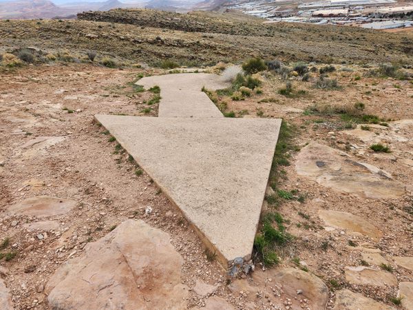
Access to the Quail Creek Airmail Arrow is becoming more difficult because of ongoing commercial development along old US-91 (now 6300 W). A Jeep trail used to run down to old US-91, and is still shown on Google Maps, but it is now blocked by construction. For now it is still possible to walk through the new development on foot, but that is subject to change.
Once on the old Jeep trail, follow it as it winds uphill to the arrow. The elevation gain is several hundred feet and the footing is a bit rocky, but the route is a straightforward hike. The distance overall is about half a mile.
If it becomes necessary to bypass the commercial development, a powerline running roughly north-south immediately behind the newly developed area intersects old US-91 at about 37.19340 N, 113.40419 W, roughly 0.6 miles north of the suggested parking point. You could follow the trail along this powerline back south to its intersection with the Jeep trail, at about 37.1866 N, 113.40593 W.
Old US-91/6300 W intersects Utah State Route 9 about 0.9 miles west of where SR-9 intersects Interstate 15, at exit 16. Follow old US-91/6300 W roughly 2.3 miles and park. This point is about where the Jeep trail from the arrow used to come out.


